
 All our Gold Routes have been run and checked by us and come with comprehensive route guides. Other routes are recommended by members by choice (not as a default)
We put a lot of time and effort into researching and surveying the best routes for running around the UK. All our Gold routes have been run and checked by us and our Silver routes have been reviewed by us or are used by Running Clubs. We use the following standards as a guide when selecting routes.
| suitable terrain for running | |
| attractive/interesting scenery | |
| easy to follow directions | |
| not hazardous to runners | |
| different to other local routes | |
| ideally a circular route |
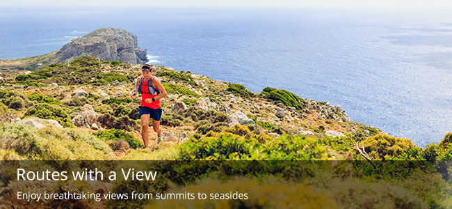
We've picked out out top 5 favourite running routes from around the UK. They all have attractive scenery or interesting views and are well worth travelling a bit further to get to if you are in the area.
Great Brtain has an incredibly diverse and attractive landscape and running is a great way to explore this, allowing you to take in many fantastic views and interesting landmarks while still sticking to your training schedule. We've picked some of our favourite routes across various themes that show where running can take you if you go out and explore.
| TIPS FOR A SAFE & ENJOYABLE RUN | |
| 1 | Look through all the information available before setting off. |
| 2 | You can get driving directions to the start of the route from the Route Overview page. |
| 3 | Wear running shoes suitable for the terrain and weather. Bear in mind that routes surveyed in the Summer may be more muddy at other times of the year! |
| 4 | Read our advice article on Running Safety - if you are exploring somewhere new and remote it may be an idea to run with a friend. |
| 5 | Allow plenty of time for running a new route so you can read the map carefully and enjoy the surroundings. |
| 6 | Take the Route Directions as well as the map as they may have additional information about key turnings. |

 Good Run Guide - The UK's Leading Independent Running Website